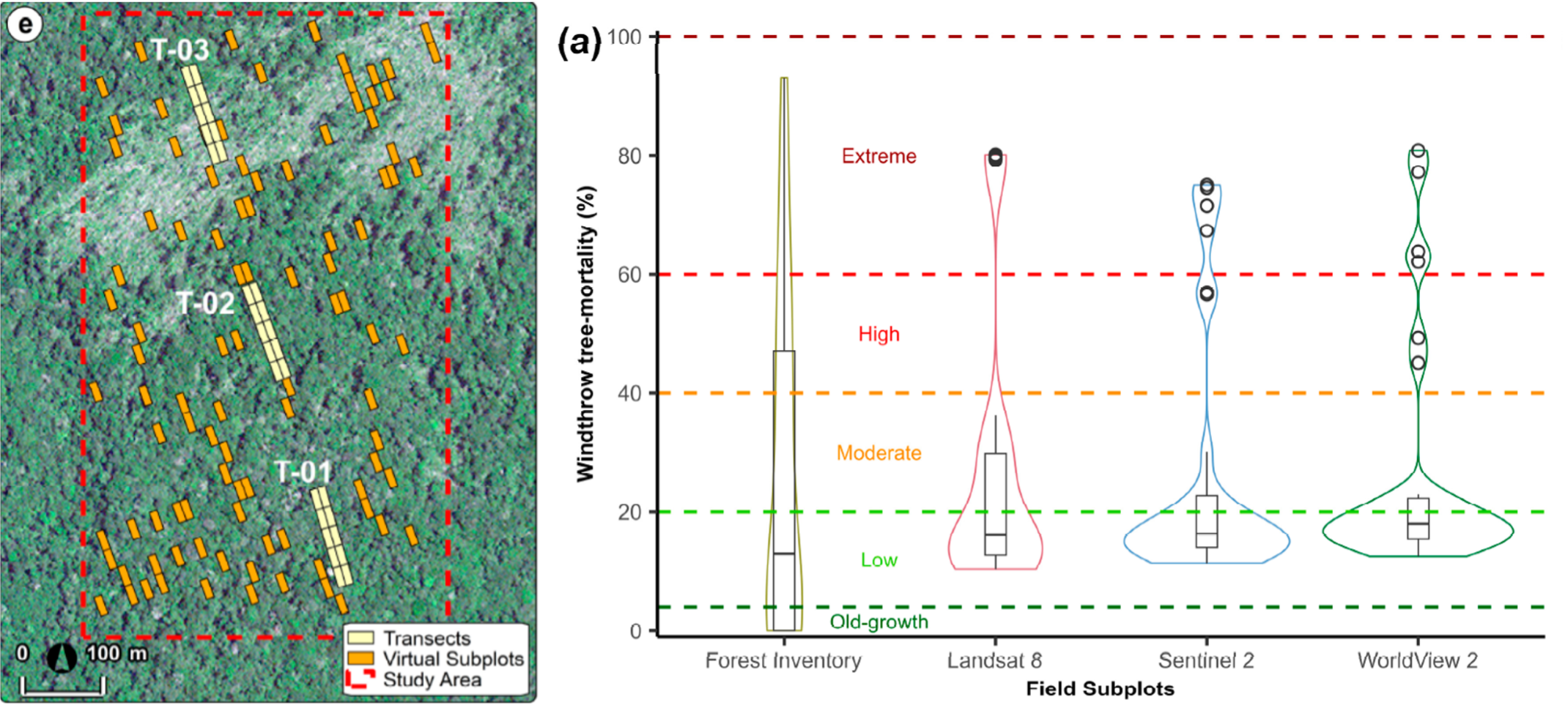
(left) Windthrown forest located near Manaus, Central Amazon, Brazil, and inventory and
virtual plots used to quantify tree mortality. (Right) Distribution of windthrow tree mortality (%) from field subplots and satellite data with varying spatial resolution.